NASA Citizen Science
1. I worked as Data Processing Technician for ACRE. ACRE is an international program of the World Meteorological Organization, the Environmental Information Recovery Institute, and NASA Citizen Science. Conicet and UTN Buenos Aires are part of ACRE Argentina. This project has representations in different countries of the world.
📌Project: Meteororum ad Extremum Terrae
Within the framework of the international project ACRE (Atmospheric Circulation Reconstructions over the Earth), through ACRE AR, we propose the imaging and digitization of documents – books, ship logbooks, personal, company and estancia records, train station records – containing weather records, for ther preservation.
The databases recovered will be included in national weather archives as well as in those belonging to international institutions, such as the World Meteorological Organization. The data will also be provided to modellers developing statistical circulation models of the Earth´s atmosphere for the XIX and XX centuries. Recovered weather records are an incredible asset to test climate models.
📌One proyect was: Interdecadal variability in Antarctica
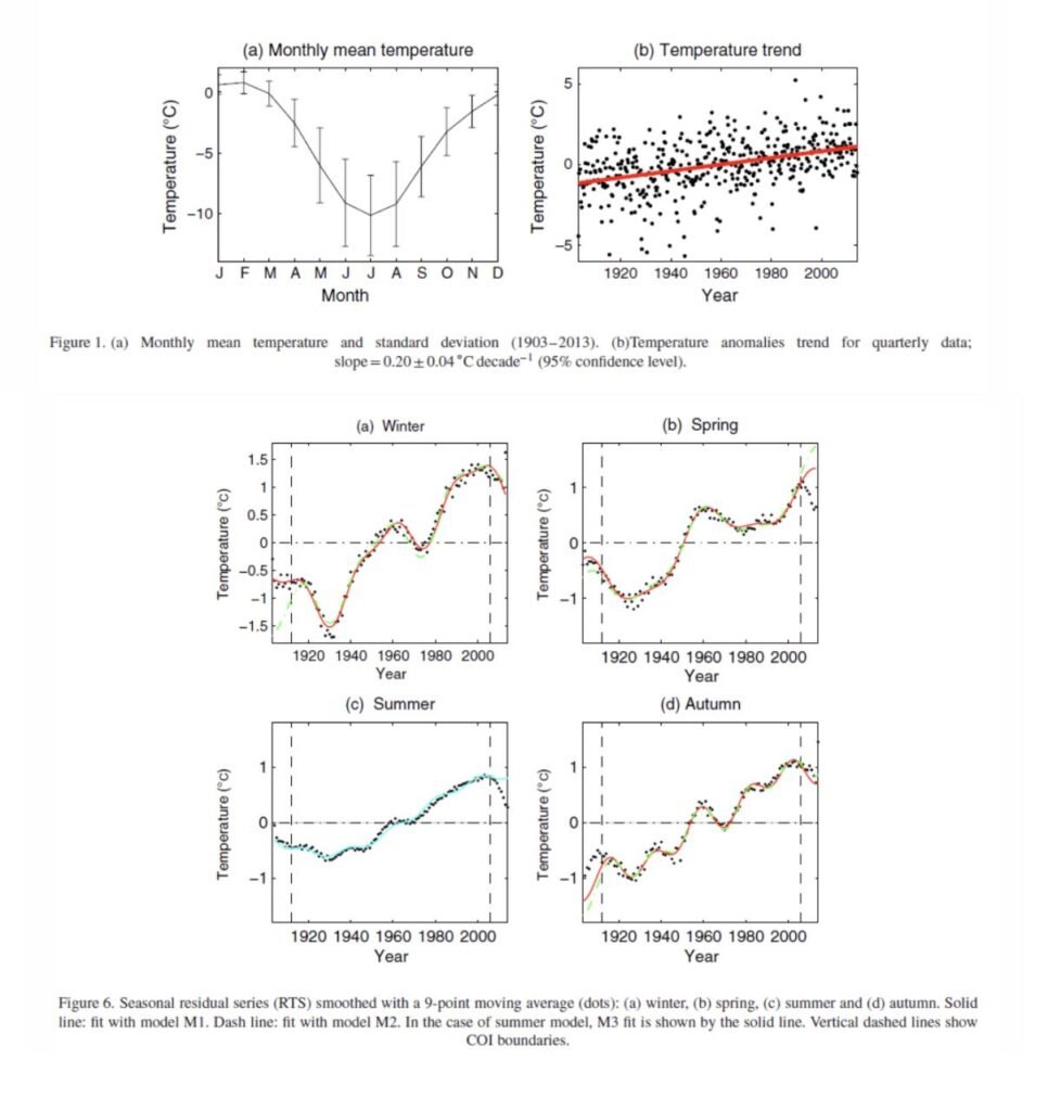
Using currently available monthy mean temperature records between 1904 and 2013 from the Base Antartica Orcadas, Zitto el al. (2013) estimaded the seasonal interdecadal variability modes present in the longest continuous observational record available for Antarctica. Furthermore they compared their results with variability inferred from ice-core samples. Ver simillar results were obtained for the ice-core samples belonging to glaciers near the base of the Antarctic Peninsula. The following images from Zitto et al. (2015) highlight the warming trend at Orcadas as well as the seasonal modes of variability which, depending on season yield quasi-20 year, quasi-30 year and quasi-50 year periods.


2. I worked as data engineer freelance for MAPPPD (Mapping Application for Penguin Populations and Projected Dynamics) which is part of NASA’s citizen science projects and MAPPPD is the product of an international collaboration of Antarctic researchers collecting data to study how this fragile polar ecosystem is changing through time.
The tool takes penguin populations a step further by integrating advanced modeling techniques to detect and count penguin colonies from remote sensing data. MAPPPD also calculates occupancy probabilities and presents graphical results that project how penguin populations change over time.
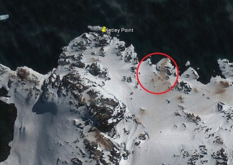
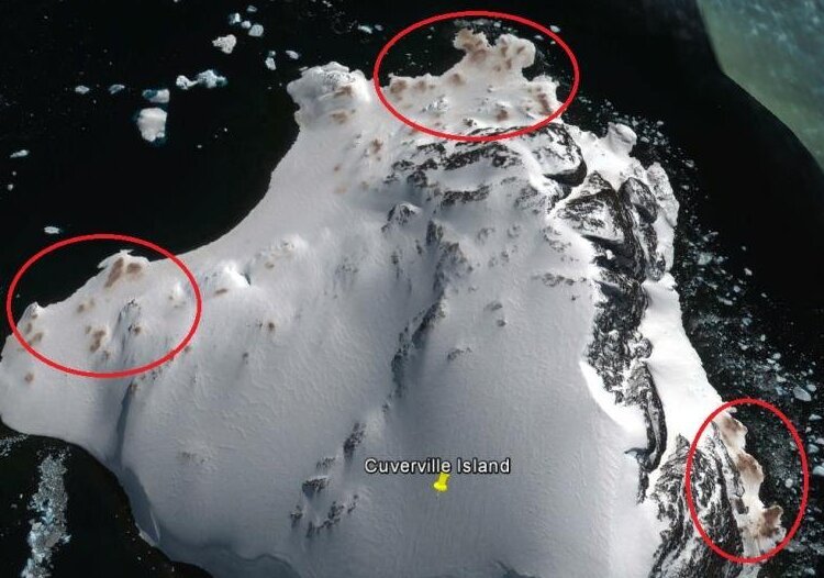
In recent years, penguin biologists have been hard at work finding all the penguin colonies in Antarctica using satellite imagery. However, the massive expansion of the continent and the challenges of finding every last penguin colony leave many likely undiscovered. I work as a detective for a penguin colony using Google Earth.

